


Bristow - Mullen - Lynch - Bush Precinct, Boyd County, Nebraska
About
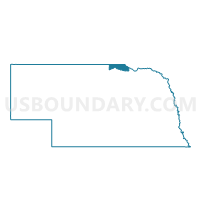
Outline

Summary
| Unique Area Identifier | 612454 |
| Name | Bristow - Mullen - Lynch - Bush Precinct |
| County | Boyd County |
| State | Nebraska |
| Area (square miles) | 172.44 |
| Land Area (square miles) | 168.21 |
| Water Area (square miles) | 4.24 |
| % of Land Area | 97.54 |
| % of Water Area | 2.46 |
| Latitude of the Internal Point | 42.84728220 |
| Longtitude of the Internal Point | -98.47244050 |
Maps


Graphs
Select a template below for downloading or customizing gragh for Bristow - Mullen - Lynch - Bush Precinct, Boyd County, Nebraska


Neighbors
Neighoring Voting District (by Name) Neighboring Voting District on the Map
- 006 NIO Precinct, Knox County, NE
- Precinct 4, Holt County, NE
- Spencer - Morton Precinct, Boyd County, NE
- VTD precinct 1, Charles Mix County, SD
- VTD precinct 4, Charles Mix County, SD
- VTD precinct 5, Charles Mix County, SD
- VTD-Gregory county precinct 3, Gregory County, SD
Top 10 Neighboring County Subdivision (by Population) Neighboring County Subdivision on the Map
- White Swan township, Charles Mix County, SD (681)
- Spencer township, Boyd County, NE (651)
- Lynch township, Boyd County, NE (303)
- Wahehe township, Charles Mix County, SD (266)
- Raymond township, Knox County, NE (207)
- Ree township, Charles Mix County, SD (140)
- Morton township, Boyd County, NE (110)
- Bristow township, Boyd County, NE (103)
- Bush township, Boyd County, NE (77)
- Paddock township, Holt County, NE (71)
Top 10 Neighboring Place (by Population) Neighboring Place on the Map
Top 10 Neighboring Unified School District (by Population) Neighboring Unified School District on the Map
- O'Neill Public Schools, NE (5,389)
- Wagner School District 11-4, SD (3,830)
- Andes Central School District 11-1, SD (2,242)
- West Boyd Public Schools, NE (1,637)
- Niobrara Public Schools, NE (788)
- Lynch Public Schools, NE (593)
Top 10 Neighboring State Legislative District Lower Chamber (by Population) Neighboring State Legislative District Lower Chamber on the Map
Top 10 Neighboring State Legislative District Upper Chamber (by Population) Neighboring State Legislative District Upper Chamber on the Map
- State Senate District 40, NE (31,744)
- State Senate District 43, NE (31,106)
- State Senate District 26, SD (21,575)
- State Senate District 21, SD (21,057)
Top 10 Neighboring 111th Congressional District (by Population) Neighboring 111th Congressional District on the Map
Top 10 Neighboring Census Tract (by Population) Neighboring Census Tract on the Map
- Census Tract 9403, Charles Mix County, SD (3,323)
- Census Tract 9402, Charles Mix County, SD (3,142)
- Census Tract 9762, Knox County, NE (3,106)
- Census Tract 9712, Gregory County, SD (2,190)
- Census Tract 9758, Boyd County, NE (2,099)
- Census Tract 9740, Holt County, NE (1,645)